Stock No: 14877
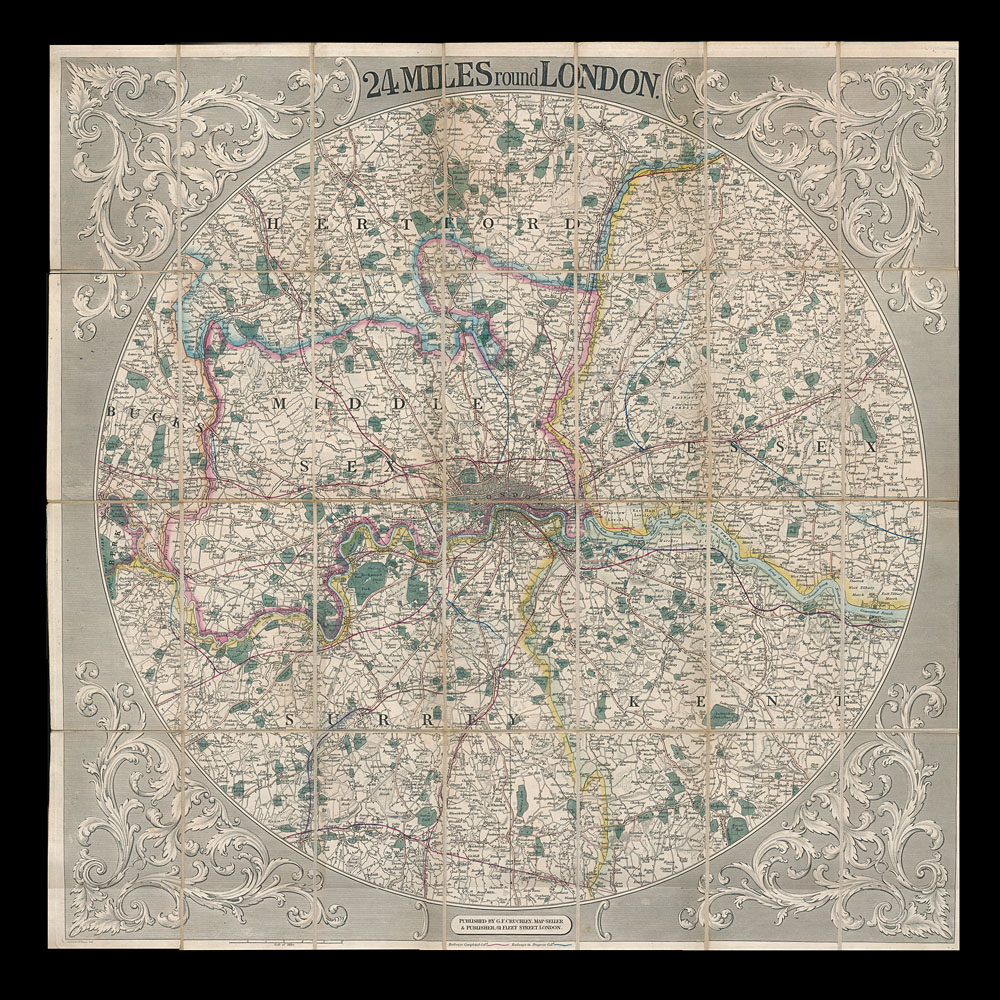
A wonderfully detailed early Victorian antique folding map of London and its environs in vibrant original hand-colour with original slipcase as pictured.
Published by G. F. Crutchley, 81 Fleet St London, 1st January 1841.
The map spans the River Thames from Windsor to Gravesend incorporating all of modern day London including, to name but a few, Fulham and Chelsea, Hampstead, Richmond and The City of London. It clearly shows the great parks of London and is also annotated with fascinating historical references, such as the Millbank Prison at Pimlico designed by Jeremy Bentham as a Panopticon. Also shown are a number of central London farms still in use in the mid-19th century as the city expanded around them. Take a step back in time and let the mind's eye wander through a byegone age.
English, published in 1841.
Link to: antique wall tapestries, panels and paintings
| Width | Height | ||
|---|---|---|---|
| 27 13⁄16" 70.5 cms |
27 13⁄16" 70.5 cms |
||